 Prev Photo
Next Photo
Prev Photo
Next Photo Back
Back
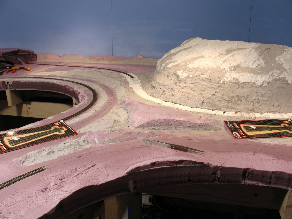
Another example of trying to visualize the way the terrain was before the track went through. We have a high hill to the upper right, descending down. Note how the triangular rise in the center of the photo is really a logical extension of the descending hill, and the track base (in white) "cuts" through. Also note how the other marked-in track lines break left and right around the smaller rises in terrain. So the overall terrain goes from high in the upper right, to low in the lower left, and "man’s influence" just has to cut its way through.
 Click for full-size photo